Tourist Attractions
- Details
- Written by Christina Horne
- Category: Tourist Attractions
Bundaberg Rum Distillery
In 1888, the first barrel of Bundaberg Rum literally rolled out of the production line. 110 years later, Bundaberg Rum, through its trials and tribulations, has gained recognition as one of Australia's famous Aussie spirits. In 1986 the Bundaberg Distilling Company appointed its first tour guide and demand soon saw the need to expand the tourist operation.
Avenue St
Bundaberg East QLD 4670
https://www.bundabergrum.com.au/
https://www.facebook.com/pages/Bundaberg-Rum-Distillery/1478680912229229
- Details
- Written by Christina Horne
- Category: Tourist Attractions
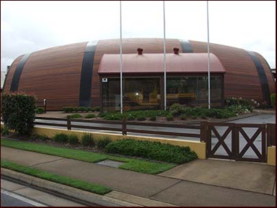
The Bundaberg Barrel
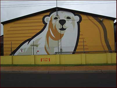
Holidaying and need ideas on what to do in Bundaberg? Discover the secrets of Bundaberg Ginger Beer with a variety of hands-on activities at the home of ginger beer.
Take an amazing journey through the True Brew Experience Tour. Use our interactive touch screens to see what happens to the humble ginger root as it's mushed, crushed, brewed and fermented to make the world's finest ginger beer.
https://www.bundaberg.com/the-barrel/
https://www.facebook.com/BundabergBarrel
- Details
- Written by Christina Horne
- Category: Tourist Attractions
Hinkler Hall of Aviation
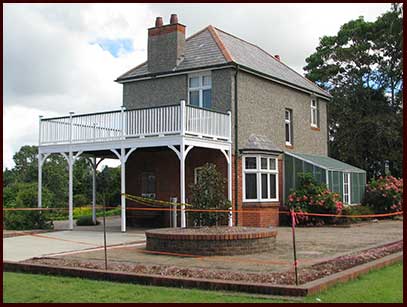
The Hinkler Hall of Aviation, located in the Bundaberg Botanic Gardens on the city’s northern outskirts, is a major Australian tourist attraction operated by the Bundaberg Regional Council. The complex is an outstanding example of several communities working together with all levels of government to celebrate and honour the life and pioneering efforts of Bundaberg’s own aviation pioneer, Bert Hinkler.
Hinkler House
Mt Perry Road
North Bundaberg QLD 4670
https://www.hinklerhallofaviation.com/
https://www.facebook.com/HinklerAviation
- Details
- Written by Christina Horne
- Category: Tourist Attractions
Bundaberg Railway Museum
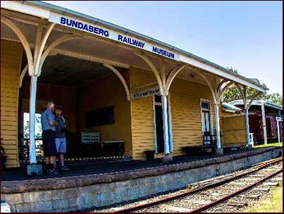
Bundaberg's first railway station, built in 1881 as an outlet for the Mt Perry railway bringing copper from the mines, is now preserved as a railway museum. Located some 500 metres from its original site, the museum houses a wide variety of railway items past and present:
Bundaberg Railway Museum
Wilmot Street
North Bundaberg QLD 4670
https://www.bundaberg.qld.gov.au/directory-record/5155/north-bundaberg-railway-museum
https://www.facebook.com/groups/366140757363297
- Details
- Written by Christina Horne
- Category: Tourist Attractions
Bundaberg Regional Art Gallery
The Bundaberg Regional Art Gallery (BRAG) is a large multi-purpose visual arts facility located in the heart of Bundaberg City, and is within walking distance to major shopping centres, cafes and restaurants and the Riverside Parkland
Bundaberg Regional Art Gallery
1 Barolin Street
Bundaberg Q 4670
https://www.artsbundaberg.com.au/galleries
https://www.facebook.com/bundabergregionalgalleries
- Details
- Written by Christina Horne
- Category: Tourist Attractions
Woongarra Marine Park
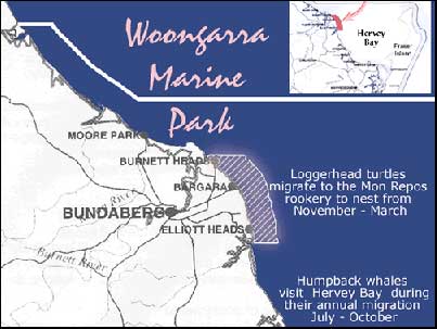
When exploring Great Sandy Marine Park from north to south, access the northern waters of the marine park from Bundaberg. Travel north to the Kolan River, then onto Littabella Creek and Baffle Creek. East of Bundaberg is Bargara and the Woongarra Coast with its fringing reefs. Head south to Elliot River, Woodgate and the Burrum River.
https://parks.des.qld.gov.au/parks/great-sandy-marine
- Details
- Written by Christina Horne
- Category: Tourist Attractions
Mystery Craters
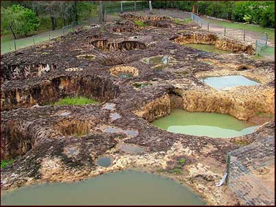
This bizarre rock formation, located inland from Bundaberg continues to baffle the world! These 'Mystery Craters' which are believed to be at least 25 millions years old, offer a unique viewing experience for visitors and tourists.
This rock, mineral and fossil display including precious stones, polished stones and gemstones have been collected throughout Australia and other countries.
How and why did the craters form is mystifying even to scientists today. One can only guess – maybe they are a a sink hole, remnants of the dinosaur era, an after mark of a volcanic eruption steam hole, or were they man made? Scientists and all who visit continue to scratch their heads in amazement and are baffled as to how they came to exist!
There are 35 unusually shaped craters which were found in 1971 by a previous owner ploughing his field to plant zucchinis. Scientists date these Mystery Craters to be about 25 million years old. They are a unique mixture of sandstone and ochre. Some of the craters hold water, whilst others rise and fall over time while some do not hold water at all, which means they do not link up!
Get a birds eye view of these mysterious craters from the public viewing platform, allowing you to look directly down on these unexplained crater holes. You can even have your very own voice guided tour of the craters thanks to our automated guide. It is a definite bucket list tick off.
Can you solve the mystery?
https://www.mysterycraters.com.au/
https://www.facebook.com/pages/Mystery-Craters-South-Kolan/193149507375001
- Details
- Written by Christina Horne
- Category: Tourist Attractions
Bundaberg Botanic Gardens
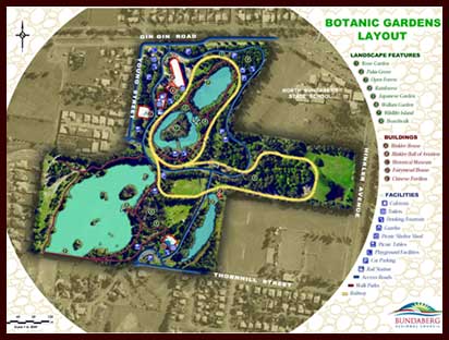
The Bundaberg Botanic Gardens are open to the public from 5:30am til 6:45pm during the months September to April, and from 6:30am til 6pm during the months May to August.
A great way to spend a day in the Bundaberg Region is in the sub-tropical surrounds of the Bundaberg Botanic Gardens. For further information on attractions and opening times including the Hinkler Hall of Aviation
https://www.bundaberg.qld.gov.au/botanic-gardens
https://www.facebook.com/BundabergBotanicGardens
- Details
- Written by Christina Horne
- Category: Tourist Attractions
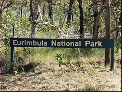
Eurimbula National Park
Captain James Cook, with botanist Sir Joseph Banks, made his first landing in Queensland on this picturesque coastline. Botanically rich, the parks protect areas of wind-sheered coastal plant communities, tropical rainforests and mangroves.
Lieutenant James Cook, with botanist Joseph Banks, made his first landing in Queensland on this picturesque coastline. The park is botanically diverse and protects mangroves, coastal vine thickets and littoral rainforest.
Location
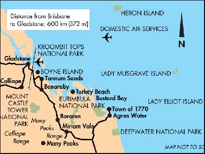
About 112km north-west of Bundaberg, central Queensland coast, Australia.
Accessible by
- 4WD
https://parks.des.qld.gov.au/parks/eurimbula
- Details
- Written by Christina Horne
- Category: Tourist Attractions
Deepwater National Park
The park's diverse vegetation of coastal scrubs, eucalypt woodlands, wet heaths and sedgelands surround Deepwater Creek and its tributaries. Tannins and other substances leached from surrounding heath plants stain the creek water brown. The creek is fringed by tall forests of swamp mahogany, paperbark and cabbage palms, and is broken in places by shallow sections of reed bed and paperbark forest. In these areas water only flows during the wet season.
Park features
The park's diverse vegetation of coastal scrubs, eucalypt woodlands, wet heaths and sedgelands surround Deepwater Creek and its tributaries. Tannins and other substances leached from surrounding heath plants stain the creek water brown. The creek is fringed by tall forests of swamp mahogany, paperbark and cabbage palms, and is broken in places by shallow sections of reed bed and paperbark forest. In these areas water only flows during the wet season.
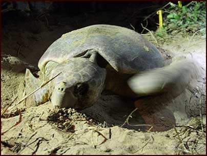
Deepwater supports diverse birdlife such as emus, red-tailed black-cockatoos, honeyeaters, brahminy kites and waterbirds. Nesting turtles frequent Deepwater Beach from October to April; turtle hatchlings emerge from the nests from January, usually at night.
- Read more about the nature, culture and history of Deepwater National Park.
Looking after the park
You can help protect the park and forest so it can be enjoyed now and in the future by observing these guidelines:
- Everything in the park (living or dead) is protected. Do not take or interfere with plants, animals, soil or rocks.
- Ensure campfires are put out properly with water, not sand, before retiring for the night or leaving your camp site.
- Keep your vehicle on the tracks; shortcutting and venturing off the track creates impacts such as erosion and soil compaction.
- Vehicles are not permitted on beaches.
- Use toilets if available. If bush toileting, ensure all faecal matter and toilet paper is properly buried at least 15cm deep and 100m from tracks, camp sites and waterways. Bag and carry out disposable nappies and sanitary products.
- Take your rubbish home for appropriate disposal. Do not hang rubbish bags from trees or tents. Never bury or leave rubbish in the park.
- When bathing or washing cooking equipment or clothes, always wash at least 100m from streams and lakes. Waterways and the ocean should be kept free of all pollutants including soap, detergents, shampoo, sunscreens and food scraps.
- Do not feed or leave food for animals. Human food can harm wildlife and cause some animals to become aggressive. Store food in lockable boxes.
- Contact the Queensland Government Wildlife Hotline to report: wildlife incidents, marine animal strike, marine stranding or an injured, sick or dead turtle, dolphin or whale.
Also see the guidelines for caring for parks for more information about protecting our environment and heritage in parks.
https://parks.des.qld.gov.au/parks/deepwater/about
https://www.facebook.com/pages/Deepwater-National-Park/1678672322346467
- Details
- Written by Christina Horne
- Category: Tourist Attractions
Mon Repos Conservation Park
The largest concentration of nesting marine turtles on the eastern Australian mainland occurs at Mon Repos. From November to March, visitors can see nesting and hatching turtles on the beach at night.
https://parks.des.qld.gov.au/parks/mon-repos
https://www.facebook.com/pages/Mon-Repos-Conservation-Park/588557291312134
- Details
- Written by Christina Horne
- Category: Tourist Attractions
Cania Gorge National Park
Towering cliffs, ancient caves and sheltered gorges are highlights of this park, which preserves a valuable remnant of the Brigalow Belt, Aboriginal freehand art and varied habitats for wildlife
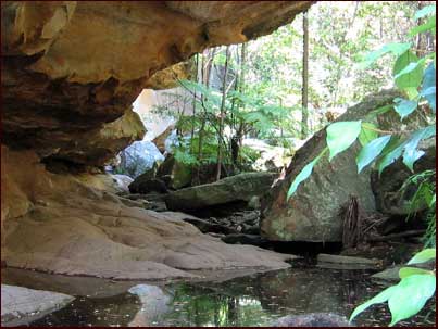
Towering cliffs, ancient caves and sheltered gorges are highlights of this park. The park protects a valuable remnant of the Brigalow Belt, First Nations people's art sites and varied habitats for wildlife. Short walks allow visitors to experience the natural sandstone features, quiet pools and dry rainforests.
Location
Cania Gorge National Park is located 500km north-west of Brisbane, 25km north of Monto and 95km south-east of Biloela in Queensland, Australia.
Cania Gorge is a national park in the North Burnett Region, Queensland, Australia.GeographyThe park is 373 km northwest of Brisbane. The nearest town is Monto. Three Moon Creek is the name of the waterway that runs along the length of the gorge.The park's most dominant features are the 70 m sandstone cliffs. Wildlife native to the park include rock wallabys, bettong, platypus, geckos and over 90 bird species.Aboriginal rock art on the cliff walls is an indication of indigenous settlement of at least 19,000 years.A picnic area is located alongside the main road into the park, 8 km from the Burnett Highway. Facilities here include covered picnic tables, toilets and gas-powered barbecues. The majority of the park's walking tracks lead from this picnic area, including the 1.1 km trail to Dripping Rock, 1.6 km trail to The Overhang, and the 1.3 km trail to Bloodwood Cave. The longest track in the park leads from a small car park 500 metres south of the picnic area. This 5.6 km circuit takes in Giants Chair Lookout, with views across the gorge; and Fern Tree Pool, a permanent waterhole. Only walkers with moderate levels of fitness should attempt this track. Another walk leads visitors to a former mine site
https://parks.des.qld.gov.au/parks/cania-gorge
https://www.facebook.com/pages/Cania-Gorge-National-Park/130233913678653
